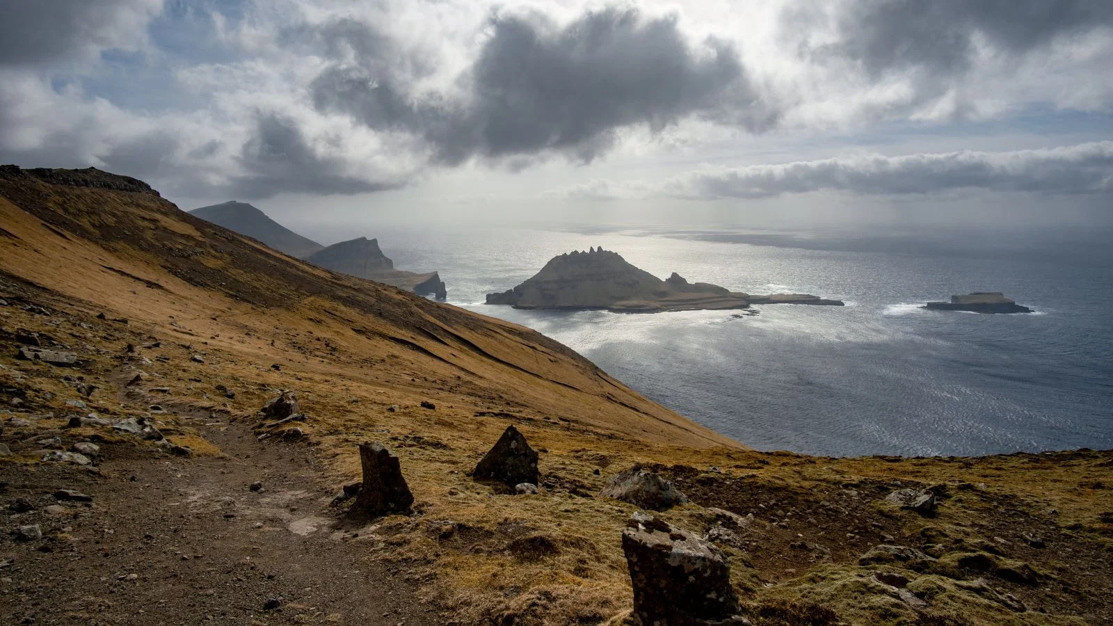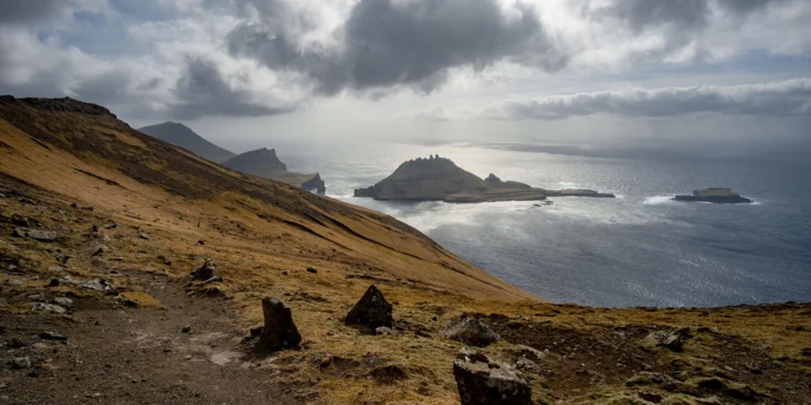
It rains three hundred days a year here. The average daytime air temperature in August is 11 degrees Celsius. There are precipitous cliffs around the perimeter
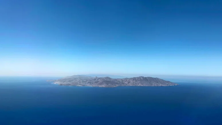
However, it didn’t prevent the Faroes from becoming one of the most appealing destinations for yacht travels. Because Norway and Iceland are popular, too, and the Faroe Islands lie halfway between them. The nearest land, which is the northern coast of Scotland, is about 250 miles south.
The archipelago of 18 islands with various population density and various names’ pronounceability was part of the Norwegian kingdom eight centuries ago. In 1814, as a result of the post-Napoleonic Wars redivision of Europe, it became part of Denmark. But since 1948 the region has become de-facto autonomous from the metropolitan country in most matters. In fact, the isolation from the continent and distinctiveness are the key factors that made the Faroe Islands so remarkable.
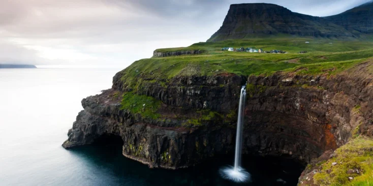
Waterfalls
The landscape of the archipelago is mainly rocky, with large differences in elevation, which is why waterfalls are abundant here. The most beautiful and photogenic is probably the Múlafossur Waterfall on Vágar island. A small river carries water to the edge of the cliff and rushes down into the ocean. The view from the sea, from a yacht, is particularly impressive.
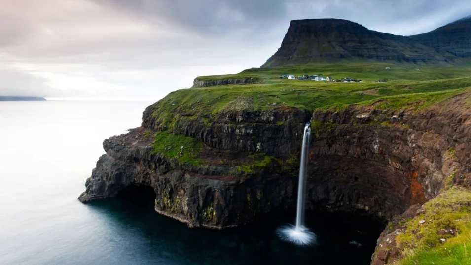
Until early 2000s it was really hard to get here by land: the village of Gasadalur, located near the waterfall, was the only settlement in the Faroes with no road. In 2004 a driving tunnel was built, but before that people could get here only via the paths in the mountains.
Fishing
Almost every family in the Faroe Islands has a boat. It is not surprising, taking into account the geography: no point in the islands is more than five kilometres away from the sea. The local bays and fjords can probably boast the best catch and diversity in Europe. The revenues from the fishing industry make up over 20% of the country's GDP, and the Faroese export 95% of the products. According to local regulations, the fishermen arriving from abroad must disinfect all their equipment to get rid of potential pathogens and acquire a license. You can catch cod, haddock, flounder, shark, halibut, sea devil and a long-long list of other sea animals here.
Birdwatching
This popular direction in modern active tourism is thriving in the Faroes. The main attraction in this respect is a puffin colony on Mykines. It is an almost uninhabited island with just over a dozen residents. However, about a million puffins get together here in summer.
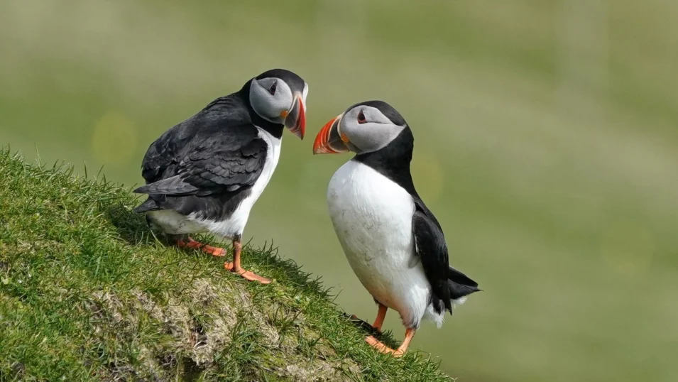
You can get here by ferry boat only in the warm season, which lasts four months of the year. During the rest of the year it can be reached only by helicopter or a private boat. The view of the magical and often foggy island of Mykines opens from the village of Gasadalur mentioned above.
Hiking
Almost all of the area of the Faroe Islands is covered with hills and low mountains, which makes it ideal for active walks. The best hiking trail is on the Kalsoy island in the north-east. It is interesting to know that its name means “man island”, while the name of the island next to it, Kunoy, means “woman island”.
About a hundred and fifty people live across four villages on Kalsoy island. All in all, there are 13 peaks to climb and 11 valleys. The most popular and picturesque trail is about five kilometres up the mountain from Trøllanes to the Kallur Lighthouse along the path surrounded by grazing sheep. The only difficulty that might arise is the weather. If it suddenly gets windy or foggy (which is quite normal for the Faroe Islands), for the sake of safety the hiking trail may be closed. If you want a more challenging trail, try going up the highest mount on the archipelago, which is Slættaratindur on Eysturoy island. Its peak is almost 900 metres above the sea.
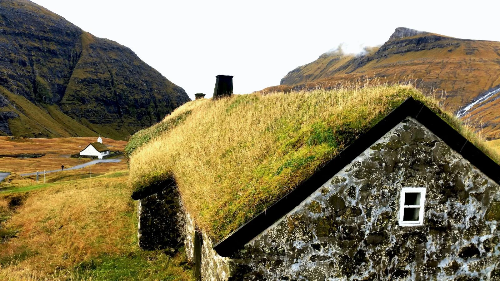
Saksun
Tiny villages with the houses that have turf and grass covered roofs are a landmark of the archipelago. There are dozens of similar settlements, but Saksun, located in the north of the main island of the Faroes, Streymoy, is probably the most beautiful one. The village is located on the hills, near a narrow fjord. At low tide, the bottom opens up and you can easily walk there.

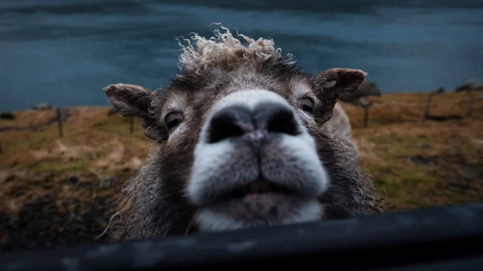
There is a sheep farm in Saksun, as the sheep is the most popular animal in the country. They say that on average there are two or even three sheep per one Faroese. The two-hundred-year-old farm operates both as a farm and as a museum.
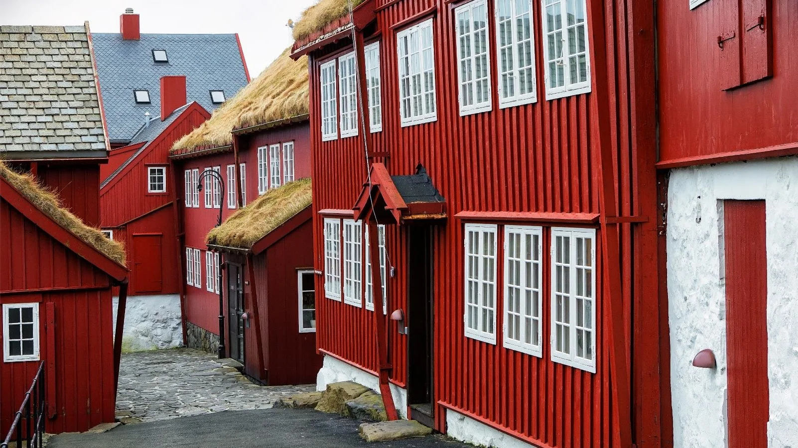
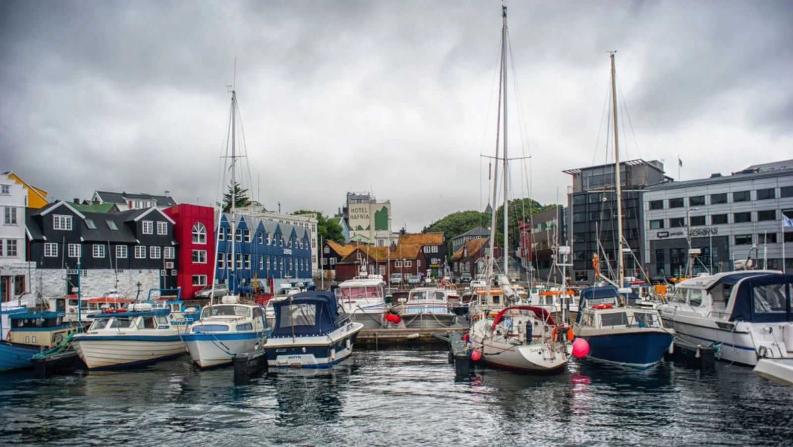
Tórshavn
The largest city in the Faroe Islands with a population of about 20 thousand people is one of the smallest capitals in the world. The city was named after the main Scandinavian god and can be translated as “Thor’s harbour”. It is also the main port and the only yachting marina. It works 24 hours a day and offers shore power, water, fuel and the Internet. The infrastructure is quite modest, but there is everything you need for the basic yacht maintenance.
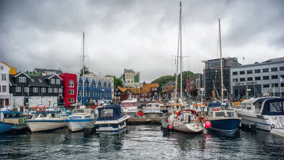
The city looks really cute, with its low houses, fishing boats in the port, narrow streets and mountains in the background. Surprisingly, Tórshavn managed to escape the fate of many cities built largely of wood. It has never been destroyed by fire and it is really well looked after, so most of the buildings look exactly like they did two or three centuries ago.

The lake above the ocean
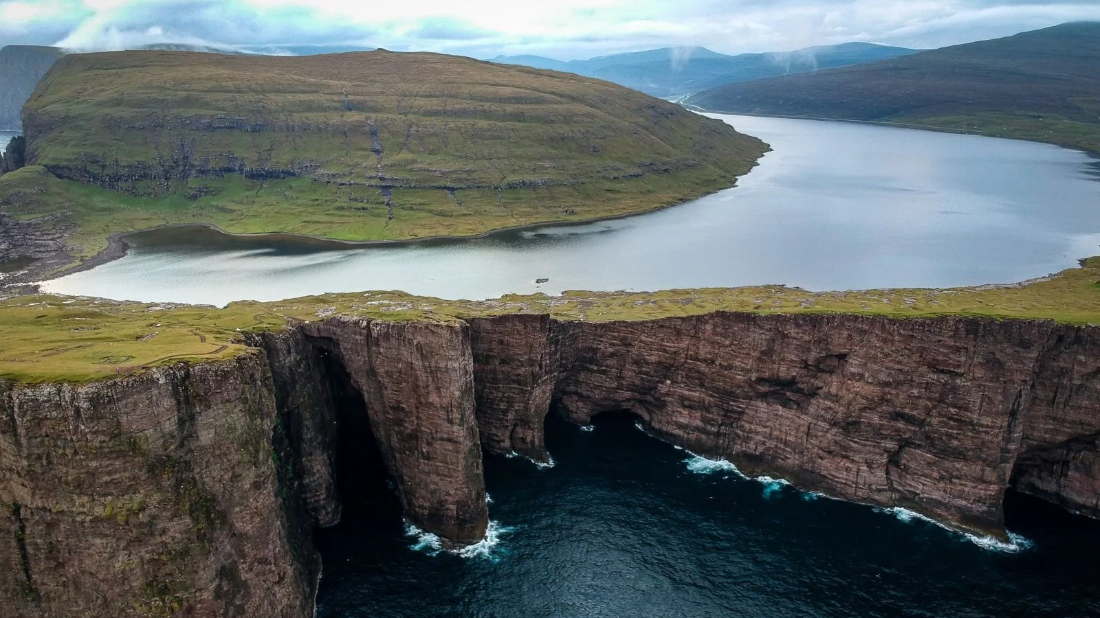
Make sure you don’t miss an absolutely unique place on the island of Vágar, to the west of the main island of Streymoy: Sørvágsvatn, or Leitisvatn. It is the largest lake of the Faroe Islands, and the residents of its opposite shores call it different names.
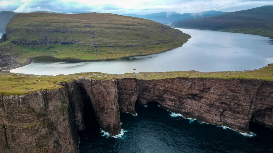
Due to its location from a certain angle it looks like it is floating over the cliffs, about 50 metres above the ocean. To reach the best observation point you should go along the lake for four or five kilometers or get here by helicopter. In the western part the lake ends with the Bøsdalafossur Waterfall, which plunges from the height of 30 metres right into the Atlantic Ocean.
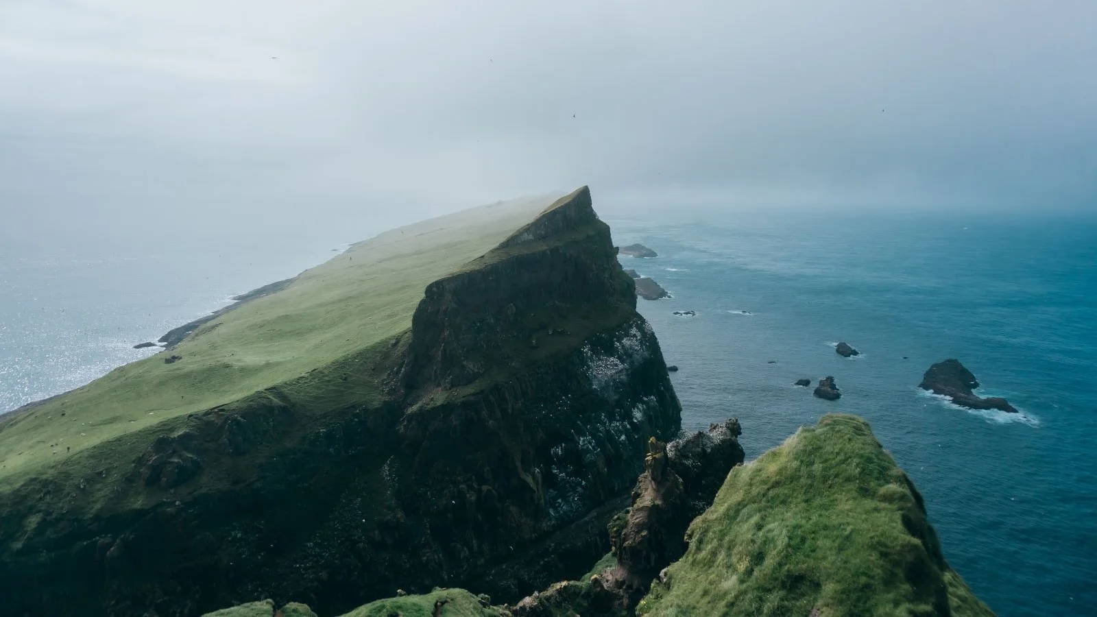
Cliffs
Thanks to the location and the geological structure the Faroe Islands can boast incredible cliffs of all sizes, colours and structure. On the island of Viðoy there is Cape Enniberg, which is the northmost point of the archipelago and the world’s highest cliff above the sea of 754 metres. It looks most spectacular from the sea, from a yacht.

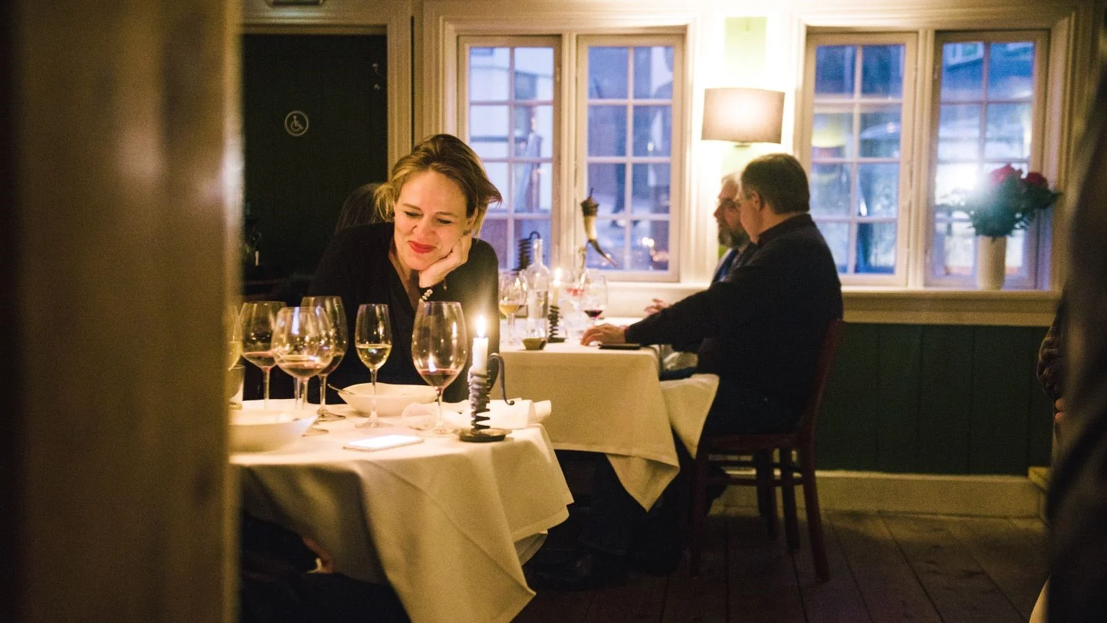
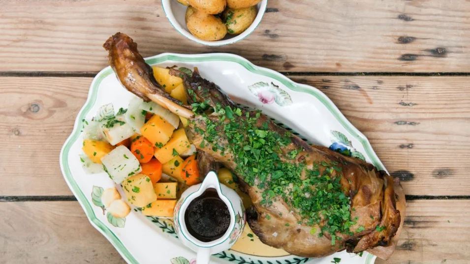
Cuisine
In tune with the most modern trends for locality and distinctiveness, most Faroese restaurants use only local foods and draw inspiration from the past. The main ingredients are fish, seafood, luxurious organic meat. Due to the climate there are not a lot of vegetables here, but the Faroese are great at fermentation and pickling techniques. The must-haves of the gastronomic program are wind-fermented lamb, dried fish, sheep's head, and langoustines.
Talking of restaurants, one can mention “Ræst” in Tórshavn, named after the Faroese specialty mentioned above, the wind-fermented lamb. The menu also features whale meat, traditional fisheman’s soup, swede and carrot pie.

“Aarstova” is another restaurant in the centre of the capital not far from the port. It offers a set menu for the guests to try different Faroese specialties, including salmon, lamb tartare, baked cod and bisque. Over the last decade Northern Europe has been a trendsetter in cooking, and the Faroe Islands are deservedly at the forefront of Nordic cuisine. Сome, you will not regret it.
You have successfully subscribed to our newsletter